Looking for a Berlin map? You have come to the right place. On this page you’ll find a collection of various different useful, rare and informative Berlin maps, available both online and offline: Berlin street maps, public transport maps, historical maps, PDF, etc.
I will continuously add more links to more maps as well as draw some by myself. Additionally I will also add more and more links to Berlin maps that you can purchase online – mostly street maps and historical maps.
And if you happen to come across an interesting Berlin map, that is not listed here yet, then please feel free to let me know and/or add a pointer to the comments section. Thank you!
Berlin Wall Map (PDF)
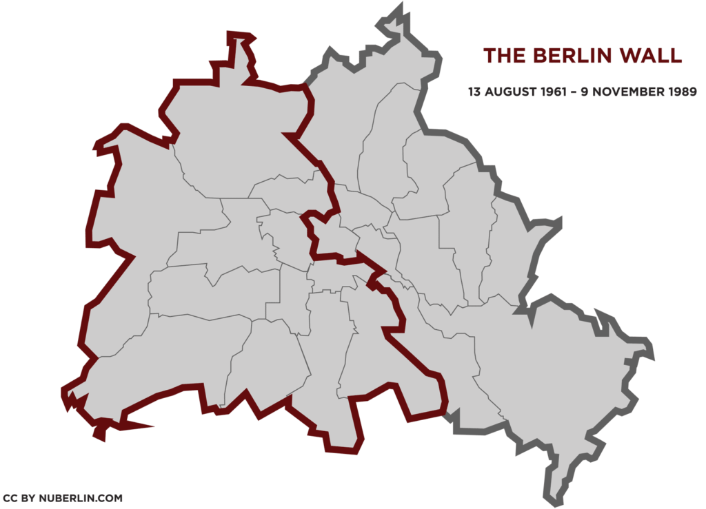 |
The Berlin Wall
|
Berlin Street Maps online
- berlin.de/stadtplan – the ‘official Berlin Street Map’ – a feature rich city map on the official homepage of the City of Berlin, featuring street and address search, parking garages, tourist sights, hotels, museums, public transport etc.
Berlin Street Maps you can buy and take with you
Berlin (Falk Plan) (German Edition)The classic foldable popout street map of Berlin– The Falk-Plan. The first map I had when I first moved to Berlin. At amazon.com: Berlin (Falk Plan) (German Edition) |
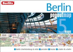 |
Berlin Berlitz PopOut MapA foldable popout street map of Berlin city center that fits in your pocket, public tranport map included At amazon.com: Berlin Berlitz PopOut Map (Berlitz PopOut Maps) |
 |
Berlin (City Map)This street map contains a booklet attached to the cover, including a street index, a Berlin metro plan and a map of the Greater Berlin area – useful, if you want to really explore Berlin and the surrounding region, lakes etc. At amazon.com: Berlin (City Map) |
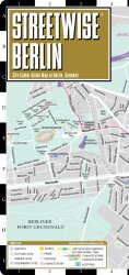 |
Streetwise BerlinA laminated street map of Berlin’s City Center, public transport map included |
Berlin Transport Maps: S-Bahn, U-Bahn, Tram, Metro, Night lines etc.
- BVG Journey Planner > Map – an interactive map of Berlin with all public transport lines: S-Bahn, Subway, Tram, Metro, Buses, Ferries
- link to PDF-Download of Berlin S-Bahn and U-Bahn map – the inner city grid (“S+U-Bahnnetz mit Regionalbahn: Innenstadt”)
- link to PDF-Download of Berlin S-Bahn and U-Bahn map – the complete grid (ABC) (S+U-Bahnnetz mit Regionalbahn: Berlin ABC)
- link to PDF-Download of Berlin Tram Map (“Straßenbahnnetz”)
- link to PDF-Download of Berlin Night Lines map (“Nachtnetz”)
- ‘Live view’ on Berlin’s public transport vehicles – a continuously updated street map – see Busses, Trams, U-Bahn etc. moving across the city in real time. Or actually not ‘real’ real time – but almost.
- Parken / Parking – The map shows you where P+R and public parking lots, parking zones, parking garages are located in Berlin.
Berlin Transport Maps: Bicycle, Car, Traffic
- BBBike – route planner for cyclists
- Bicycle Route Planner – an online tool that lets you find routes recommended for cycling across Berlin City
- Berlin Traffic Map – just click on the map labeled ‘traffic map’ and you’ll get a map of Berlin with construction sites, traffic jams and closed roads – a service by the City of Berlin
- Map of Berlin parking zones – a map listing all Berlin parking zones together with their respective parking fees and parking hours (google map)
Berlin Shopping Maps
- Recycling goes fashion: directory and map of various upcycling fashion and design shops in Berlin
- Neukölln Schatzkarte (Neukölln Treasure Map) – A map/list of over 50 shops and cafés in Neukölln: “The places where we eat, shop, work and play are what makes our community feel like home.” (map download / PDF)
Historical Berlin Maps – reprints you can buy online
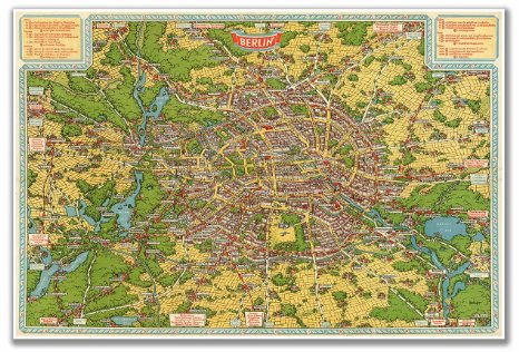 |
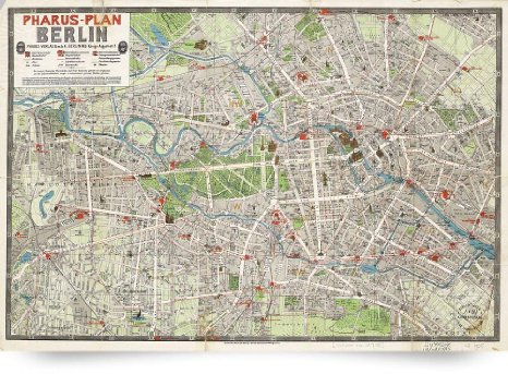
Birds Eye Map of Berlin circa 1931Another historical map of Berlin: the “Birds Eye Map” – circa 1931 Vintage Reproduction 24″ high x 36″ wide (610mm high x 915mm wide) View details / buy at amazon.com: Birds Eye Map of BERLIN circa 1931 24″ x 36″ (610mm x 915mm) |
 |
1905 Vintage Map of Berlin Germany (Giclee Art Print)See Berlin’s city center as it was on this vintage street map from 1905: the Brandenburg Gate, the old City Castle, the Tiergarten – Map Reprint available in different sizes: 23.1″x 16″ – 61″x41.4″ View details / buy at amazon.com: Vintage Map of Berlin Germany (1905) (Giclee Art Print) |
Historical Berlin Maps (online)
- HistoMap Berlin – an interactive tool to navigate a vast collection of historical Berlin maps by overlaying the current Berlin street map.
- Alt-Berlin.info – a tool to navigate a vast collection of historical Berlin maps from 1738 through 1989 (start page) (German start page)
- Berlin 1860 – a map layer that lets you navigate the historical City Center of Berlin. Very nice: you can see parts of the historical Berlin Wall, including all the historical gates
- S-, U- und Straßen- Bahn Netzspinnen – a directory of historical public transport maps
- List of historical maps of Berlin – at Wikimedia Commons
Berlin Wall Maps (online)
- The Wall inside the city – an interactive map showing the former course of the Berlin Wall inside the city – featuring memorial sites etc.
- Berlin Wall Map at Google Maps, showing rather exactly where the Berlin Wall used to be.
- Memorial Landscape Berlin Wall – an interactive map (google map) with texts and media about the Berlin Wall by ‘Stiftung Berliner Mauer’
Berlin Transport Maps
- BBBike – route planner for cyclists
- Map of Berlin parking zones – a map listing all Berlin parking zones together with their respective parking fees and parking hours (google map)
- Bicycle Route Planner – an online tool that lets you find routes recommended for cycling across Berlin City
- Berlin Traffic Map – just click on the map labeled ‘traffic map’ and you’ll get a map of Berlin with construction sites, traffic jams and closed roads – a service by the City of Berlin
Special Berlin Maps (online)
- Stolpersteine – a map with of over 6000 Berlin Stolpersteine / stumble blocks listed (more on Berlin Stolpersteine / stumble blocks)
- Pumps of Berlin is an interactive map of “all” free accessible bicycle pumps across the city: “Got a flat? Or do you just want to keep your tires perfectly pumped? Here’s where to go!“
- Refill Stations in Berlin – refill your water bottle for free
- Ping Pong Map: find ping pong tables on this interactive online map: (pingpongmap.net)
- Post Boxes: Want to send a postcard from Berlin, but don’t know where the next post box is? The Deutsche Post has an easy to use online tool for that: just enter your current location (in most cases street name will do) and the interactive map will show you where to find post boxes (“Briefkästen”). If you want to find a post office instead, you just need to click on “Filiales” and the tool will show you a map with the nearest post offices. And (of course) the ‘post box finder’ also works on mobile devices.
- Recycling Centers – BSR service stations where you can leave trash like furniture, renovation leftovers and TV sets etc. (more on trash and recycling)
- Berlin Craft Beer Map – craft beer locations in Berlin over at withberlinlove.com
- Berlin Cerry Blossom Map – where to see Cherry Blossom in Berlin (PDF Download)
- The Berlin Swimming Map – a map of Berlin lakes, open air swimming pools and public transport (how to get there) [OFFLINE]
Berlin by Numbers / Berlin Statistics
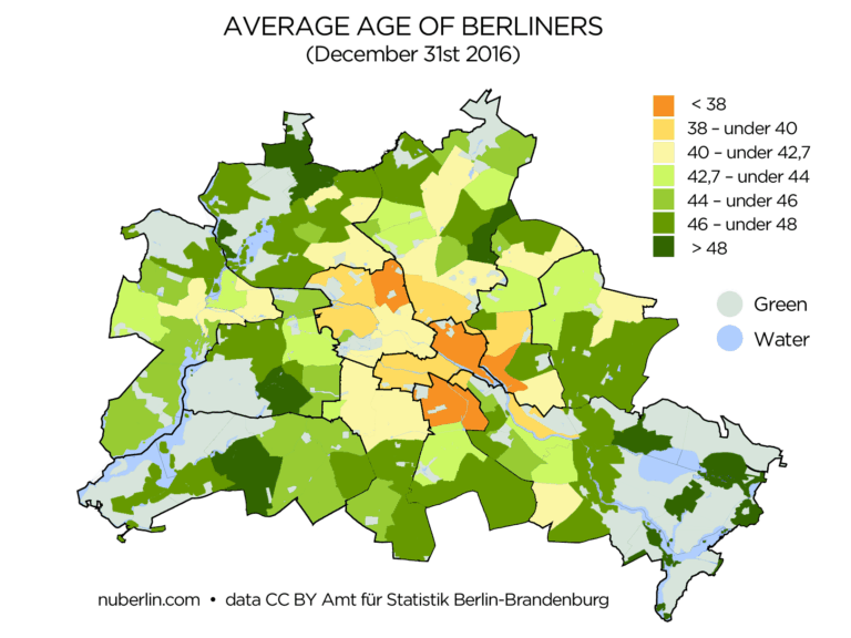 |
Average Age of BerlinersHow old is the average Berliner? A look at the official statistics provides some insight: the average age of an average Berliner is currently 42.7 years … |
Do you have any additional recommendations, thoughts or suggestions about this subject? Then please feel free to leave a comment below. Thank you!
